
What remains of Kogerah as the Gadigal people and their ancestors saw it?
The rushes have disappeared and the creek has long since been covered over. Nawi and their expert navigators no longer ply the harbour, and the forest of eucalypt is no more.
But hints can be seen in the area’s topography, which follow undulating lines and feature Aboriginal place or street names. Womerah Avenue, is named after a throwing stick which increases the range of a spear. Yurong Street and lane is named after a steam which ran to Woolloomooloo Bay.
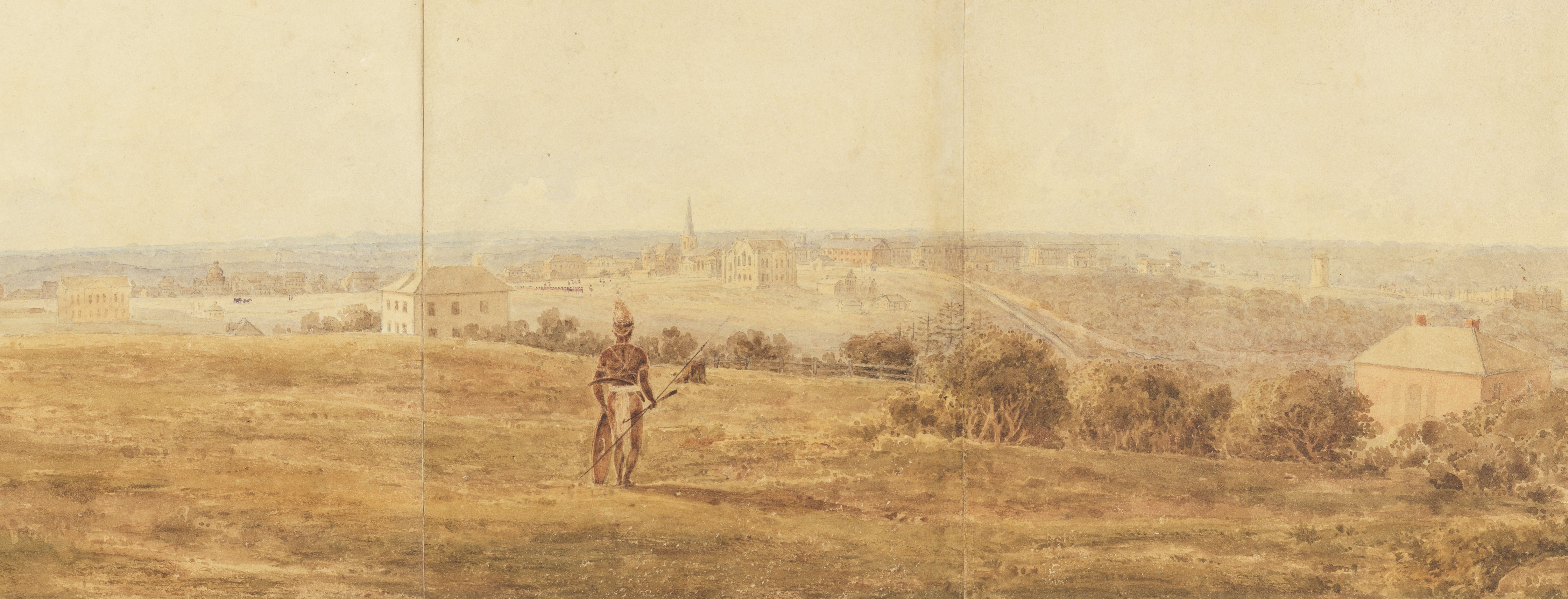
An Aboriginal man surveys the city from Darlinghurst, c1836
[Panorama of Darlinghurst], unknown artist, State Library of NSW, XV1A/Darh/2
In a watercolour by an unknown artist dated about 1836, there is a view depicting Sydney town from the hills of Darlinghurst. A cottage, two timber mills and a stone mill, located near Darlinghurst Gaol, dominate the scene. But zoom in on the work and an Aboriginal man can be seen surveying a much-altered, stolen land.
Does he look beyond at the structures built by the berewalgal - the spire of St James Church, the cupola of the Supreme Court, and the sandstock bricks of Hyde Park Barracks - all symbols of colonialism? Or does he gaze upon the line of “red coats” (soldiers) in the distance in Hyde Park, which was once a contest ground for Aboriginal people?
He holds a womera, spear and shield and is equipped with a boomerang. He shows us that he is still on Country.
Read the next story: From ‘Pretty Hamlet’ to City in the Clouds.